GPS Musings
 Last week I spent most of my time traveling. The goal was the 10th annual Telecosm, at
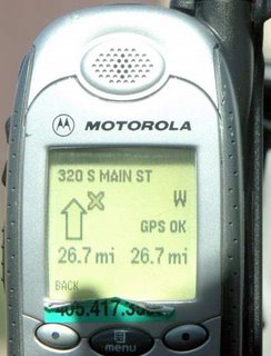
 I got something looking like an old mobile phone. Antenna, keypad, small monochrome display. After many months with a Kenwood unit built into the dashboard of the Subaru or another months of using the iGO on my HTC smartphone, the unit I was supplied with by
But as I was traveling and taking pictures, I kept on uploading them to the Picasa Web galleries (have a look). Picasa has this nice feature allowing you to "Geotag" the pictures. Geotagging works in tandem with Google Earth and correlates position coordinates with actual pictures stored in Picasa. Very nice feature, but really requires some work, to pick the picture, find the corresponding place in Google Earth, and repeat the process for all pictures in he library. Wouldn't it be nice, if my camera had a built-in GPS unit, allowing it to store the position coordinates within the metadata area of JPG files? Looking at any JPG picture, you can see the camera make and model, time the picture was taken, aperture / shutter settings and so on. So isn't it a cool idea to have the geo coordinates stored there as well? Then the Google applications (Picasa, Picasa Web, Google Earth, and Google Maps) could make use of it, bringing you the enhanced slideshow option, with your pictures mixed with Google Earth animations? I cannot wait to have it. To be honest, the GPS module will be the important differentiator when I will be selecting my next digital camera. So who is the first to do this? Kodak? Sony? Will see...
The idea of a GPS-enabled camera led me to the question - how many GPS units are you going to have with you? GPSes used to be expensive (I remember the first Magellan models of late 1980s listed for 20000$). The used to consume much power and were slow, not to mention poor sensitivity and requirements of external antennas. This has changed a lot with SiRF being one of the most important contributors to the current state of GPS market. SiRF is one of my favorite companies, and its stock price ascend in 2005 helped me fund many gadgets and leisure activities. The SiRFstarIII chip took the market by storm delivering an unmatched GPS performance. I use a small, battery powered "Bluetooth GPS antenna" based on SiRF to feed satellite signals to my HTC smartphone running iGo. It is sensitive enough to be stored in a glove compartment or even under a seat and still receives the signals. There are solar - powered versions as well, so you can just place the unit somewhere on the dashboard and forget about recharging its batteries. So why not have another SiRF built in my camera?
The other nice idea is the GPS logger, a matchbox-sized, solar-powered unit. You drop it in your car, it stores all the route coordinates along the way, and after the trip you can display the trip on one of the mapping applications. This brings me to the conclusion we may be again at the right entry point to load some SiRF shares. They have been down from the 40$/2005 highs to current 20-and-a-change. SiRF is about to introduce the new chip, with even lower power consumption, possibly integrated Bluetooth (after the Impulsesoft acquisition) and even shorter fix times. The GPS devices are yet to hit the mainstream consumer market, and in the end we will have them everywhere.
Professional SLR digital cameras have GPS support e.g. Nikon D2Xs. Unfortunately it is big and heavy. Piotr.
ReplyDelete